
Why is the restoration and protection of Errigal important?


Why are conservation works needed?
As its popularity has grown over the years, a key challenge for Errigal has been unmanaged access to its summit and associated upland areas which, in combination with natural erosion, has resulted in the degradation of the natural resource and the loss of important habitat.
A conditional assessment report was carried out on the mountain in 2018. See the full report here. The following extract from the report highlighted the need for intervention to prevent further deterioration of the habitats.
“Errigal Mountain is a typical upland ecosystem with habitats (wet heath and blanket bogs) that are sensitive to natural and anthropogenic damage. The land on the lower slopes of Errigal has been used in the past for extensive sheep grazing and turf cutting. The turn of the 21st century saw a dramatic increase in walkers climbing Errigal, generally using the most ‘direct’ route located west of the stream from the car park”.
“Footpath erosion, together with on-going wind and water erosion, is now re-shaping the landscape of the mountain at a rapid rate”.
“The dry summer of 2018 brought heavy walkers’ traffic and the trampling of vegetation extended to an even wider area in both the ‘Direct Approach’ and ‘Stream Side’ routes, especially at the lower slopes of the eastern part of the stream, up to a point where walkers cross the stream to join the existing Direct Approach’ route. The subsequent heavy rainfall during the autumn 2018 eroded the now almost-bare area. Erosion has been exacerbated by damage of walkers climbing peat hags. The steeper areas have seen continued erosion with more material being moved down”.
This assessment supported the design of a sustainable access path along the eastern side of the steam which will assist the restoration of the most degraded areas currently within the SAC while removing additional pressures on other parts.
The following gallery of photos shows the additional erosion since the report was carried out in 2018 and the path following the completion of the ‘Sustainable Access and Restoration Project on Errigal’ in November 2022.

Existing path right of stream 2018

Main path, right of stream 2021

Path following completion Nov 2022

Damage to deep peat hags 2018

Damage to deep peat hags 2021

Path following completion Nov 2022

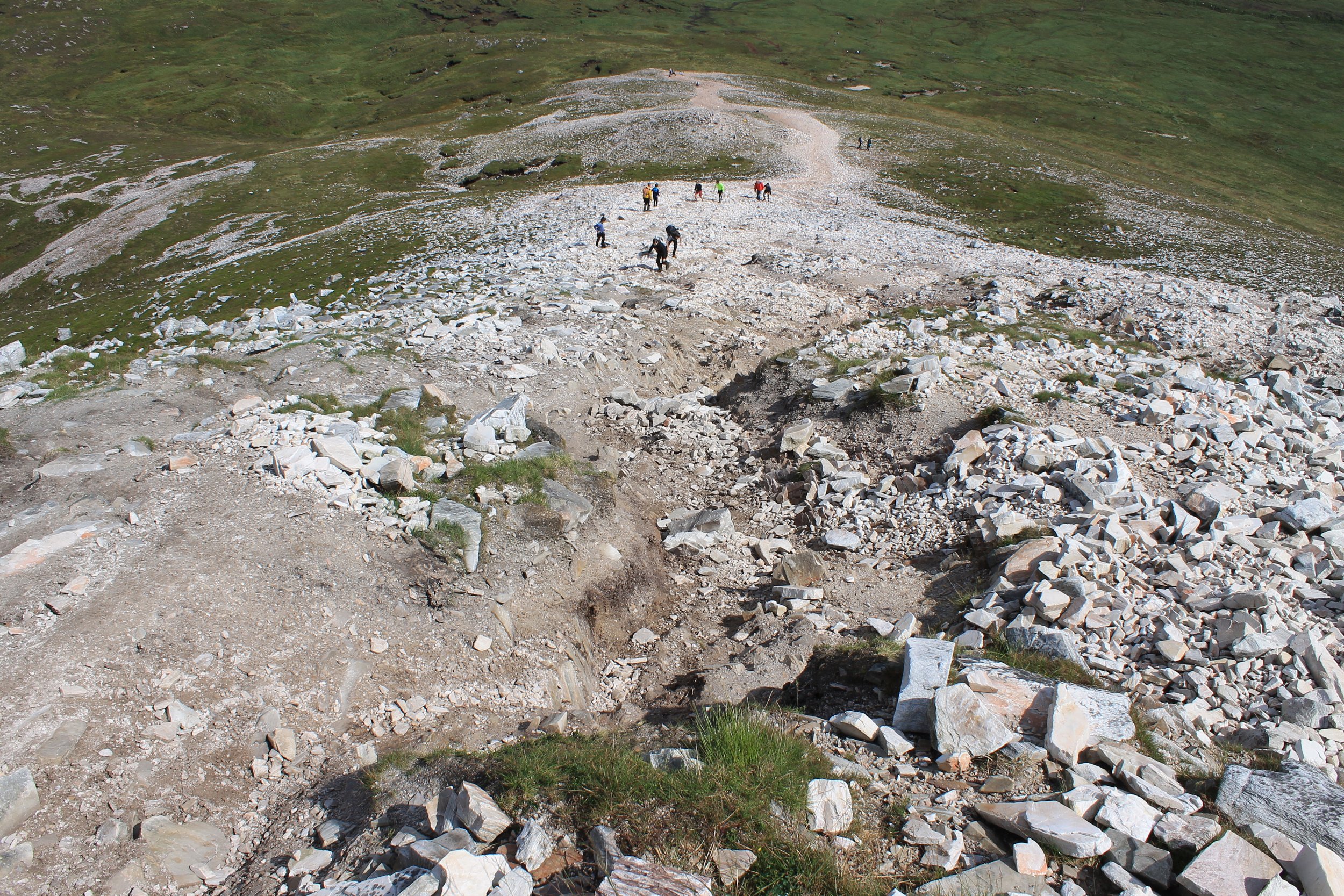
The steep ridge, 2018

The steep ridge, 2021

The steep ridge, Nov 2022

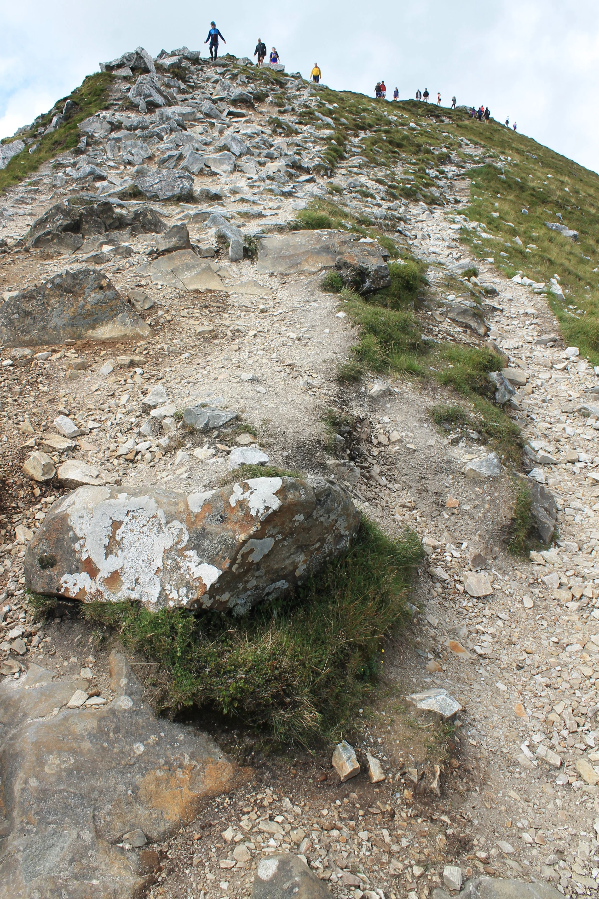
'Braids' forming on the main ridge, 2018

further expansion of the 'braids' on the ridge, 2021
Obstacles placed to stop traffic on braids Nov 2022

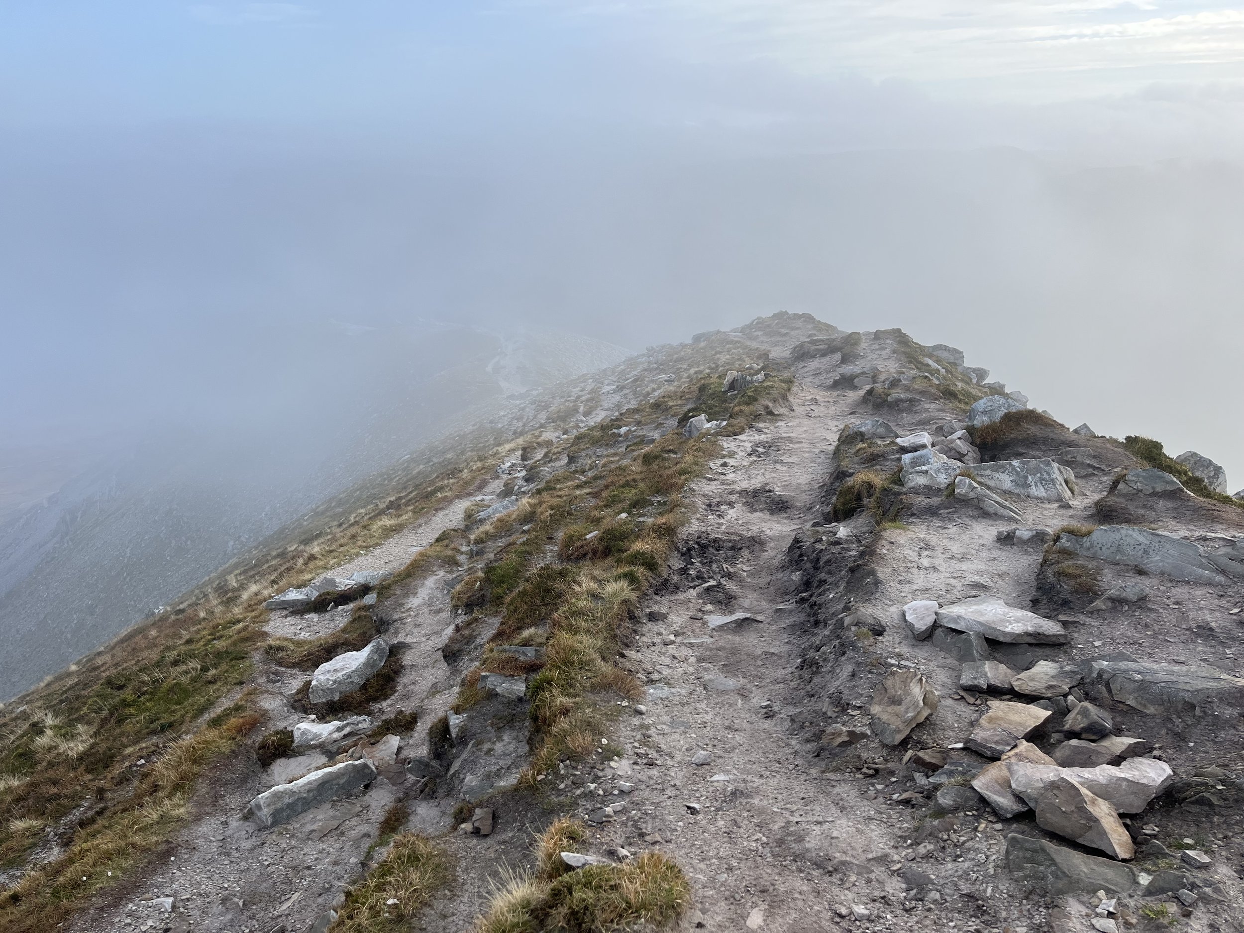
Between the ridges 2018

Between the ridges 2021

The new path blending into the landscape Nov 2022

View from the carpark 2017

View from the car park 2021 - note the widening of the path and removal of blanket bog

View from the car park 2022 - the mountain is showing signs of recovery